


The parking lot at Hayters Gap holds ten cars. On a Saturday morning in October, it’s full by 8 AM and there is no overflow.
That one detail changes how you plan this entire trip. The Great Channels of Virginia rank among the most unusual geological formations on the East Coast, but unprepared hikers drive two hours and turn around without ever reaching the trailhead. Most trail guides don’t mention the parking situation until paragraph six.
This guide covers both routes to the Great Channels, every decision point on the Brumley Mountain Trail, and the arrival strategy that separates a successful hike from a wasted drive.
QUICK ANSWER:
The Great Channels hike via Brumley Mountain Trail covers 6.6 miles out and back with 1,200 feet of elevation gain. Allow 3.5 to 5 hours. The trailhead parking lot holds only 10 vehicles — arrive before 8:30 AM on weekdays, before 7:30 AM on weekends.
Trail Overview: What Makes the Great Channels Unique
| Detail | Brumley Mountain Trail | Channels Trail |
|---|---|---|
| Distance (round trip) | 6.6 miles | 11 miles |
| Elevation Gain | ~1,200 ft | ~2,600 ft |
| Difficulty | Moderate | Strenuous |
| Estimated Time | 3.5–5 hours | 6–8 hours |
| Trailhead | Hayters Gap, VA Route 80 | Route 689, near Fletcher’s Chapel |
| Parking Spaces | ~10 | Informal pullout |
| Trail Surface | Gravel road → dirt path | Dirt path, rougher terrain |
| Crowd Level | High (especially weekends) | Low |
| Best For | First-timers, families, day hikers | Experienced hikers seeking solitude |
The Great Channels are a network of deep sandstone crevices sitting at 4,208 feet on Middle Knob of Clinch Mountain in southwest Virginia.
- Check the geology: 400-million-year-old sandstone fractured by ice-age permafrost
- Explore a 20-acre maze of slot-canyon-style passages and moss-covered walls
- Experience temperatures noticeably cooler inside the channels than outside
- Catch panoramic views of Mount Rogers and Whitetop Mountain from the summit
- Access two different trail routes — one moderate, one strenuous
The formations feel like something from Utah’s canyon country. However, these channels sit under a canopy of Appalachian hardwoods. Geologists believe permafrost and ice wedging during the last ice age shattered the sandstone cap into the fractured labyrinth hikers explore today.
The Great Channels became publicly accessible only recently. The Nature Conservancy purchased the 5,000-acre tract in 2004. Channels State Forest was established in 2008. Before that, this place was private land — off-limits to everyone.
How to Get to the Great Channels Trailhead
Getting to the trailhead trips up first-timers because GPS apps often route to the wrong location.
Driving Directions to Hayters Gap
Use 4250 Hayters Gap Road, Saltville, VA as your navigation address. This works reliably in both Google Maps and Apple Maps.
- Drive north from Abingdon on VA Route 80 for approximately 20 minutes
- Watch for the small gravel pullout on the left side of Route 80
- Look for the sign advertising Raven Ridge Lodge — the trailhead is adjacent
- Avoid following GPS to “Channels State Forest” — it may send you to the wrong entrance
The trailhead sits in a rural area with no cell service. Therefore, download offline maps before you leave town.
Parking at the Brumley Mountain Trailhead
Parking is the single biggest headache on this hike. Plan around it.
- Use only the designated 10-space gravel lot off Route 80
- Arrive before 8:30 AM on weekdays, before 7:30 AM on weekends
- Avoid parking on the road shoulder — local authorities ticket and tow
- Check that no overflow lot exists — there is none as of 2026
- Skip private property pull-offs — they result in fines
The lot fills fast even on Mondays. We strongly recommend arriving at dawn during peak season. Additionally, weekday hikes in spring and fall offer the best chance at an open spot.
Brumley Mountain Trail: Mile-by-Mile Breakdown
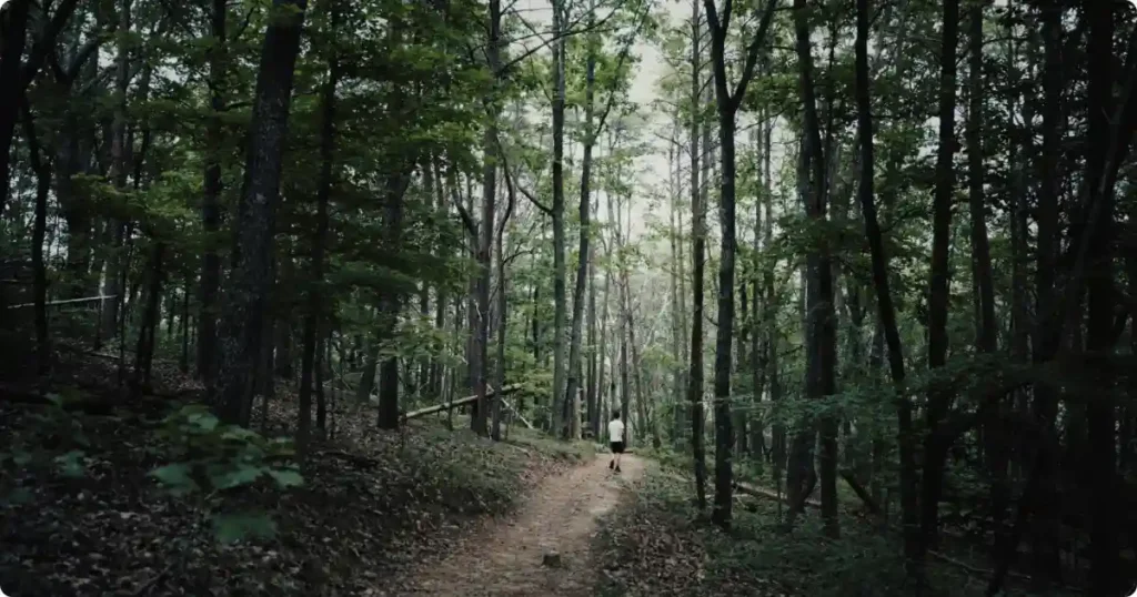
| Section | Distance | Terrain | Key Landmarks |
|---|---|---|---|
| Trailhead to Cabins | 0–1 mile | Wide gravel road, gentle incline | Raven Ridge Lodge sign, powerline vista, private cabins |
| Forest Climb | 1–2.5 miles | Packed dirt, steeper grade | Channels State Forest gate, information kiosk |
| Spur Trail to Summit | 2.5–3 miles | Rocky, exposed sections | Sandstone outcrop viewpoint, Middle Knob rock field |
| Fire Tower & Channels | 3–3.3 miles | Rock field → wooded descent | Hayters Knob Fire Tower, Great Channels entrance |
The Brumley Mountain Trail is the standard route most hikers use. The full out-and-back covers 6.6 miles with roughly 1,200 feet of elevation gain.
Miles 0–1: Gravel Road Through Private Property
The first mile follows a wide gravel road through private land. The owners allow foot traffic — stay on the road and respect their property.
- Pass the Raven Ridge Lodge sign at 0.25 miles — stay left
- Skip the powerline vista at 0.5 miles unless you want a quick photo stop
- Bear left at the trail split near 0.65 miles
- Pass two private cabins near the 1-mile mark — stay on the trail
The terrain is easy here. However, the gradual uphill climb has already started.
Miles 1–2.5: Forest Trail Into Channels State Forest
After the cabins, the surface shifts from gravel to packed dirt. The trail narrows and enters Channels State Forest.
- Veer left at the Channels sign and pass through the iron gate
- Notice the trail getting steeper, darker, and rockier
- Check the information kiosk for current trail conditions
- Pick up the pace slightly — the best scenery is still ahead
This section gains most of the elevation. The forest canopy thickens. Because the trail stays shaded, summer hikes feel manageable through here.
Miles 2.5–3: Channels Spur Trail to the Summit
The final push delivers the payoff. At 2.9 miles, veer left onto the Channels Spur Trail.
- Stop at the sandstone outcrop around 2.25 miles for south-facing views
- Turn left at the intersection before the fire tower for a hidden viewpoint
- Spot Mount Rogers (5,728 feet) and Whitetop Mountain (5,520 feet) on clear days
- Walk across the rock field on Middle Knob and pass the old fire tower
- Pick up the trail on the far side of the tower heading into dense woods
The Hayters Knob Fire Tower still stands but is permanently closed to climbing. The trail continues past it and drops into the forest. Within minutes, the entrance to the Great Channels appears.
Exploring the Great Channels
The channels themselves are the reason every hiker makes this climb. Expect to spend 30 minutes to over an hour inside.
- Leave a backpack or visible marker at the entrance to find your way out
- Duck, squeeze, and climb through narrow sandstone passages
- Feel the temperature drop inside — the channels hold cold air like a cave
- Use caution on moss-covered rock — surfaces get slippery when damp
- Avoid rushing — the maze-like layout genuinely disorients hikers
INSIDER SECRET: Drop a brightly colored item at the exact spot where you enter the channels. Every passage looks identical once you’re inside. Hikers regularly spend 30+ minutes trying to find the exit without a marker.
The channels hold snow well after surrounding temperatures rise above freezing. Because of the microclimate, rare plant species thrive in the crevices. Stay on rock surfaces and avoid disturbing moss or vegetation.
The Channels Trail: The Harder Alternative Route
Most hikers take the Brumley Mountain Trail. However, the original Channels Trail offers a longer, more remote experience.
- Start from the trailhead on Route 689 near Fletcher’s Chapel
- Cover 11 miles round trip with approximately 2,600 feet of elevation gain
- Expect a full-day commitment — 6 to 8 hours minimum
- Navigate a rougher, less-maintained path through deep forest
- Arrive at the same summit point where both trails merge
This route sees far fewer hikers. Because parking pressure at Hayters Gap has increased, the Channels Trail offers solitude that the Brumley route no longer provides. However, the trail demands significantly more fitness and route-finding ability.
Both routes converge at Middle Knob. From the fire tower, the path into the Great Channels is identical regardless of which approach you take.
Best Time to Hike the Great Channels
Timing affects everything — from parking availability to trail conditions to visibility inside the channels.
- Pick spring (April–May) for wildflowers and moderate temperatures
- Choose fall (September–October) for the best visibility and cooler air
- Avoid summer weekends — heat, humidity, and full parking lots combine
- Skip winter unless prepared for icy trails and potential snow in the channels
- Use weekdays year-round for lighter crowds and easier parking
The channels themselves stay cool even in summer. However, the exposed climb on the Brumley Mountain Trail bakes in July and August heat. Early morning starts solve both the parking and the heat problem.
March through November is the general hiking window. Trail conditions vary after heavy rain — mud can make the dirt sections slick on the middle portion of the Brumley Mountain Trail.
What to Bring on the Great Channels Hike
This hike requires standard day-hike gear plus a few trail-specific essentials.
- Bring at least 2 liters of water — no water sources exist on the trail
- Use sturdy hiking shoes with grip — sandstone gets slippery with moisture
- Pack a headlamp or flashlight for exploring darker channel passages
- Download an offline trail map — cell service is unreliable at the trailhead
- Carry a bright bandana or marker to flag your channel entrance point
- Skip trekking poles for the channel section — you need free hands to scramble
No restrooms or facilities exist at the trailhead or along the trail. Plan accordingly and stop in Saltville or Abingdon before you arrive.
The Verdict
I rate the Great Channels hike as one of southwest Virginia’s best day hikes and one of the most underrated trails on the entire East Coast. The sandstone labyrinth delivers an experience closer to Utah’s slot canyons than anything else in Appalachia.
The Brumley Mountain Trail makes the channels accessible without requiring elite fitness. However, the 10-space parking lot demands early arrivals and weekday planning. First-timers should budget a full morning. Experienced hikers can pair this with nearby trails in the Abingdon area for a full weekend of exploration.
