


I’ve hiked the White Oak Canyon Cedar Run loop in every season and it consistently ranks among the best waterfall hikes in Virginia.
Most hikers show up without a plan. They pick the wrong direction, miss the best swimming holes, and hit the steepest sections when their legs are already spent. That frustration is avoidable.
This guide breaks down trail direction strategy, every major waterfall, the swimming holes worth stopping for, and exactly what to pack. No filler just the details that shape a better day on the trail.
QUICK ANSWER: The White Oak Canyon Cedar Run loop is a 7.9 to 8.8-mile circuit in Shenandoah National Park featuring six named waterfalls, natural swimming holes, and a famous water slide. It gains roughly 2,300 feet of elevation. Most hikers finish in 5 to 7 hours. Start counterclockwise (up White Oak Canyon) to face waterfalls head-on during the climb.
Trail Overview: What to Expect
| Detail | Full Loop |
|---|---|
| Distance | 7.9–8.8 miles |
| Elevation Gain | ~2,300 ft |
| Difficulty | Very Strenuous |
| Trail Type | Loop |
| Duration | 5–7 hours |
| Terrain | Rocky trails, rock scrambles, stone steps, stream crossings |
| Dog-Friendly | Yes (leash ≤ 6 ft) |
| Entrance Fee | $30 per vehicle (7-day pass) |
| Nearest Town | Sperryville, VA (~30 min drive) |
| Named Waterfalls | 6 |
This loop connects two of Shenandoah National Park’s most dramatic stream canyons via a fire road ridge connector.
- Pick this hike for waterfalls — six named falls plus dozens of cascades
- Expect 7.9 to 8.8 miles depending on trailhead choice
- Plan for 2,300 feet of cumulative elevation gain
- Allow 5 to 7 hours including waterfall stops and swimming
- Carry water shoes if planning to use the swimming holes
The full circuit begins and ends at the Whiteoak Canyon boundary parking area near Syria, Virginia. Both canyon trails are rocky and technical. The fire road section between them is wide, moderate, and uneventful but necessary to complete the loop.
Clockwise vs Counterclockwise: Which Direction to Hike
Direction matters more on this loop than almost any other hike in Shenandoah. Most hikers default to whatever feels right at the fork. That’s a mistake.
- Go counterclockwise (up White Oak, down Cedar Run) to face waterfalls head-on
- Choose clockwise only if knees are a concern — Cedar Run’s descent is punishing
- Counterclockwise front-loads the biggest waterfalls during fresh legs
- Clockwise saves the waterfalls for the second half — but legs are tired by then
I recommend counterclockwise for most hikers. The White Oak Canyon side has more defined stone steps. Cedar Run is steeper, looser, and more technical better to descend than climb. Additionally, walking toward the falls rather than away from them delivers a dramatically better experience.
White Oak Canyon Trail: The Waterfall Side
The White Oak Canyon Trail follows Robinson River upstream through a narrow, forested canyon. This is the showcase section of the loop.
- Expect continuous water views from the 0.5-mile mark onward
- Rock scrambles begin around mile 0.8 and continue through mile 3
- Stone steps built into the trail help on steeper pitches
- Six named waterfalls appear between mile 1.4 and mile 2.9
The trail is well-marked with blue blazes. However, footing demands attention — wet rocks and exposed roots are constant.
Lower Whiteoak Falls
Lower Whiteoak Falls appears at roughly mile 1.4. It’s the tallest waterfall in Shenandoah National Park at 86 feet. The cascade drops over a wide rock face into a shallow pool.
A short spur trail leads to the base. Most hikers spend 10 to 15 minutes here. Because the pool is shallow, swimming isn’t practical but the mist on a hot day is worth the stop.
Upper Whiteoak Falls
Upper Whiteoak Falls shows up around mile 2.4. It’s shorter than Lower Falls but surrounded by dramatic rock walls. Frozen icicles hang from exposed soil and rock in winter months.
Past Upper Falls, the trail reaches a signed halfway point at mile 2.8. A warning sign marks the “point of no return” — essentially telling hikers they’re committed to the full elevation gain from here. This is the honest checkpoint to assess energy levels.
The Fire Road Connector
After the final waterfall viewpoint, the trail crosses Robinson River on a footbridge around mile 3.1. Then it connects to White Oak Canyon Fire Road.
- This 1.5-mile section is wide, graded, and mostly uphill
- No waterfalls, no views — just forest walking
- The fire road merges with the Skyland-Big Meadows Horse Trail
- Turn left at the Cedar Run Trail junction around mile 5.5
This section feels dull after the canyon drama. Therefore, use it as recovery time. Eat a snack, hydrate, and prep legs for the rocky Cedar Run descent ahead.
Cedar Run Trail: The Wild Side
Cedar Run Trail drops steeply from the ridge back to the trailhead. It’s rougher, narrower, and more technical than White Oak Canyon.
- Expect loose rock, steep grades, and narrow trail tread
- The trail follows Cedar Run creek for roughly 3 miles
- Two stream crossings require rock-hopping or wading
- Footing is the primary hazard — ankle injuries happen here
Cedar Run earns its “very strenuous” rating. Trekking poles make a significant difference on this side. The descent is relentless in places, especially the first mile off the ridge.
Cedar Run Falls and Water Slide
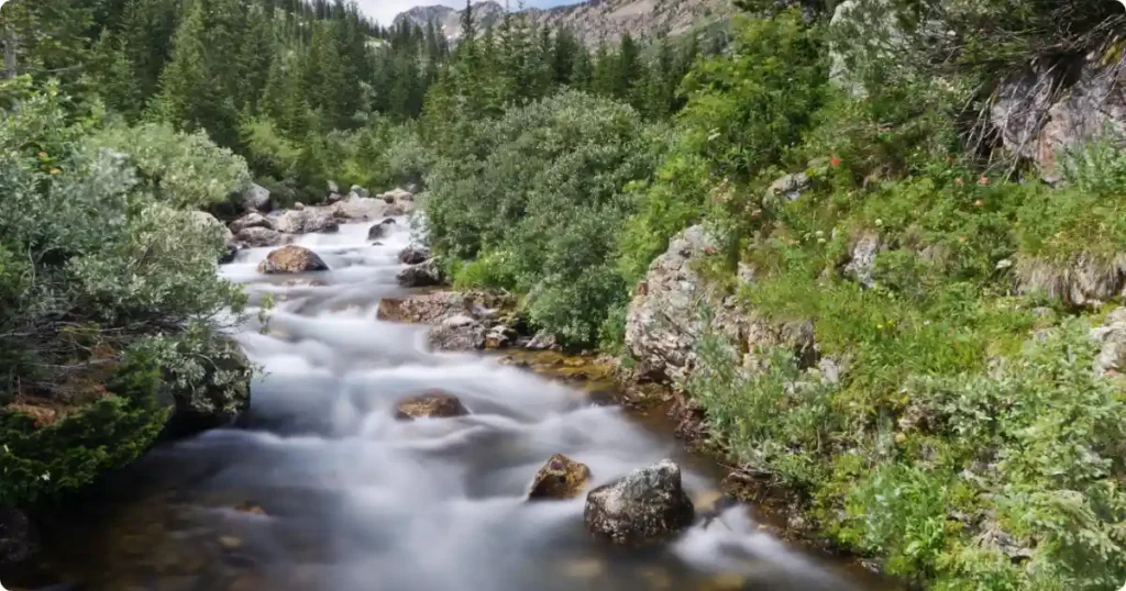
Cedar Run Falls sits about a mile into the descent from the ridge junction. The cascade drops into a pool with a natural rock water slide on one side.
The water slide is a smooth rock chute that drops roughly 10 feet into a pool. It’s popular in summer months. However, water levels vary dramatically by season. During low water, the slide is too shallow and dangerous. High water makes the pool turbulent.
INSIDER SECRET: The safest time to use the Cedar Run water slide is late May through mid-June, when water levels are consistent but not flood-stage. Scope the pool depth before committing it changes year to year.
Swimming Holes Along Cedar Run
Several natural pools line the Cedar Run descent between miles 6 and 8.
- The deepest pools sit just below Cedar Run Falls
- Smaller wading pools appear every quarter-mile along the lower trail
- Water temperature stays cold even in August — expect the mid-50s°F
- Check pool depth before jumping — rocks shift between seasons
These pools are the main reason summer hikers choose the clockwise direction. By arriving at Cedar Run mid-hike, they hit the swimming holes during peak afternoon heat. It’s a valid strategy if swimming is the priority.
Trail Difficulty and Fitness Requirements
The National Park Service rates this circuit as “very strenuous.” That’s accurate. AllTrails classifies it as “hard” with 2,273 feet of elevation gain.
- Comparable in difficulty to Old Rag Mountain — many hikers say it’s harder
- Rocky terrain covers roughly 70% of the total trail distance
- Several sections require basic rock scrambling — hands may touch rock
- Steep grades on Cedar Run demand strong knees and ankles
- Not suitable for beginners or young children without hiking experience
Most reasonably fit adults can complete this hike. However, allow extra time beyond the standard 5-hour estimate. Waterfall stops, photo breaks, and careful footing on wet rocks add up quickly.
How to Get There: Trailhead and Parking
Most hikers start from the Whiteoak Canyon boundary parking area. It’s accessible year-round and avoids driving on Skyline Drive.
- Address: End of Berry Hollow Road (Route 600), near Syria, Virginia
- From Sperryville: Take Route 231 south, turn right on Route 643 at Etlan, then right on Route 600
- Parking lot is large but fills by 9 AM on weekends from May through October
- A ranger station at the lot entrance collects the Shenandoah entrance fee
- Porta-potties are available near the trailhead
An alternative start exists at Hawksbill Gap on Skyline Drive (mile marker 45.6). This trailhead drops directly into Cedar Run and avoids the boundary parking fee but requires a Skyline Drive entrance fee instead.
Arrive before 8 AM on summer weekends. The lot does not get plowed reliably in winter.
What to Bring on This Hike
This trail punishes unprepared hikers. Gear selection matters.
- Use trekking poles — Cedar Run’s descent is steep and loose
- Carry 2 to 3 liters of water minimum per person
- Pack water shoes or sport sandals if planning to swim
- Wear sturdy hiking boots with ankle support — trail runners are risky here
- Bring microspikes in winter — snow and ice linger at elevation
Skip cotton clothing. Moisture-wicking layers handle the stream crossings and sweat far better. A dry bag keeps electronics safe during creek crossings.
Best Time to Hike White Oak Canyon Cedar Run
Timing changes the experience dramatically on this trail.
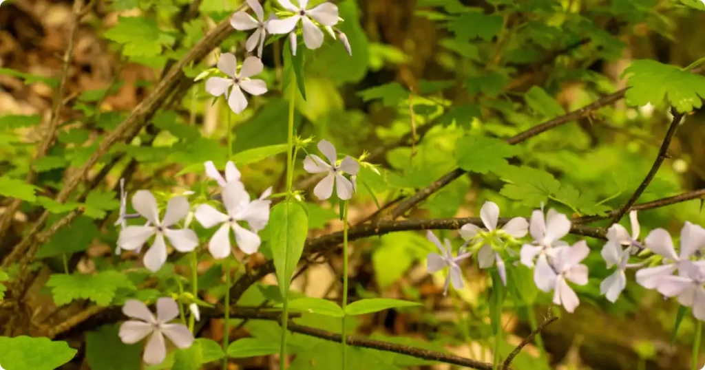
- Spring (April–May): Peak water flow, waterfalls at maximum volume, wildflowers blooming
- Summer (June–August): Swimming holes accessible, trail crowded, parking fills early
- Fall (October): Foliage peaks, moderate crowds, water levels drop
- Winter (December–February): Snow and ice on trail, microspikes required, stunning frozen falls
Late April through early June delivers the best combination of waterfall volume and manageable crowds. Additionally, wildflowers carpet the lower canyon in spring.
Summer weekdays beat weekends significantly for crowd avoidance. The trail sees heavy traffic from Memorial Day through Labor Day.
Safety and Stream Crossings
Two mandatory stream crossings on Cedar Run require careful navigation.
- First crossing at approximately mile 7.0 uses a downed tree and exposed rocks
- Second crossing near mile 8.1 is similar — manageable but slippery
- After heavy rain, water levels rise fast and crossings become dangerous
- Check Shenandoah National Park conditions page before hiking after storms
- Cell service is unreliable throughout both canyons
The Cedar Run side presents the most rescue calls on this circuit. Steep, wet rock combined with tired legs creates fall risk. Slow down on the descent — finishing 30 minutes later beats a sprained ankle.
Pets are allowed on leashes no longer than 6 feet. However, the rock scrambles and stream crossings make this trail challenging for most dogs.
Shorter Hike Options
| Route | Distance | Difficulty | Highlights |
|---|---|---|---|
| Lower Whiteoak Falls Out-and-Back | 2.9 miles | Moderate | Tallest waterfall in Shenandoah (86 ft) |
| Lower + Upper Falls Out-and-Back | 4.8 miles | Strenuous | Both major named waterfalls |
| Three Falls Out-and-Back | 5.8 miles | Strenuous | All upper cascades, viewpoint included |
| Full Loop (White Oak + Cedar Run) | 7.9–8.8 miles | Very Strenuous | 6 waterfalls, swimming holes, water slide |
Not everyone needs the full loop. White Oak Canyon offers excellent shorter routes.
- Lower Whiteoak Falls out-and-back: 2.9 miles, moderate, reaches the tallest waterfall
- Lower and Upper Falls out-and-back: 4.8 miles, strenuous, covers both major falls
- Three Falls out-and-back: 5.8 miles, strenuous, includes the uppermost cascade
All three options start from the same boundary parking area. They follow the White Oak Canyon Trail only and return the same way. Each one delivers outstanding waterfall scenery without the punishing Cedar Run descent.
The Verdict
I rate the White Oak Canyon Cedar Run loop among the top three day hikes in Shenandoah National Park. The waterfall density is unmatched anywhere else in Virginia’s Blue Ridge.
Go counterclockwise. Start early. Bring trekking poles and more water than you think you need. The fire road section is boring accept it and move through quickly.
Cedar Run’s descent demands respect. Tired legs on loose rock is where injuries happen. However, the swimming holes and cascades reward careful footwork with some of the most beautiful water features on the East Coast.
